Chez moi, a bird's eye view

Thank you, Google Earth! As always, click on the image to view a larger version.
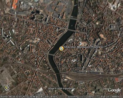
The river cutting through the center of town is the Cher. Just past the bridge that is east of my apartment there is a dam which makes the river seem bigger than it is.
The train station is visible in the photo and Carrefour (where I do all my grocery shopping) is across the river directly northeast.
To the east is the medieval centre-ville surrounded by the boulevard loop. This is where the Chateau des Ducs de Bourbon is located.

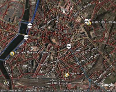
This map gives some street names (strangely enough lacking the two major road names, however!) and I also pinpointed the locations of two of my schools. It takes me 10-15 minutes to walk to Balzac and 20-25 minutes to walk to Anatole France, if that gives you any idea of distance.

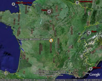
And, finally, here is Montlucon in the grand scheme of France.

1 Comments:
At 8:17 PM, Anonymous said…
Terrific idea! Thank you so much for the maps. That really helps me to "see" where you are. I love you tons and tons!!!
Post a Comment
<< Home